Rivers of Kyrgyzstan. Kyrgyzstan has more than 40,000 rivers and small streams with a total length of about 150,000 km and an annual flow of about 47 cubic kilometers of water. The main source of water for rivers is the meltwater of numerous mountain glaciers. Precipitation is less than 1/5 of the total volume of water. The source is far from the Black Sea, all rivers drain into closed drainage systems.
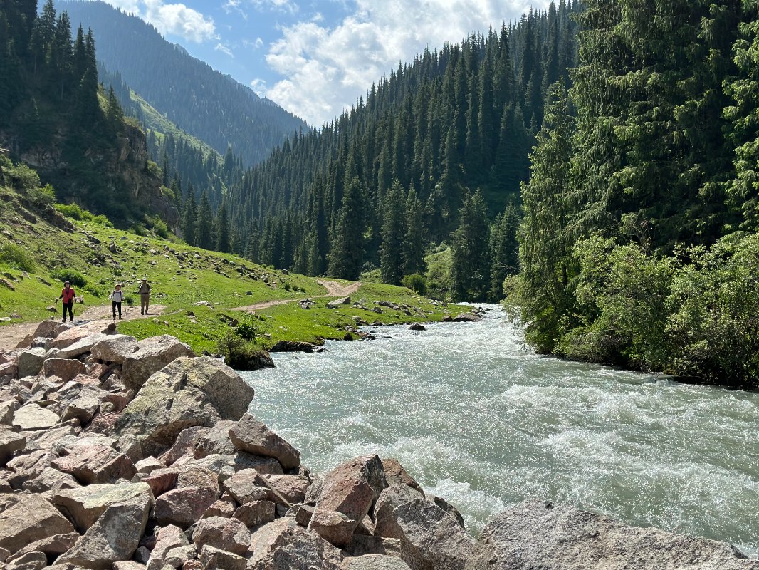
Many mountain rivers are not navigable due to large elevation differences, complex relief of the riverbed and rapid flow. Some of them are suitable for sports such as rafting.
The Naryn River is the longest river in Kyrgyzstan (807 km). It is formed by the influence of two rivers-the Big Naryn and the Small Naryn, which combine the waters of several larger tributaries, including the At-Bashi and Kekemeren rivers, then flow into the Toktogul reservoir, through the Ferghana Mountains fall into the Ferghana Valley and, combining distant tributaries, the Syr Darya River. – Darya (the ancient name of the Naryn River) flows into the Aral Sea.
Talas is a big river, but it is most famous for the fact that the Chinese were defeated on its banks in 751, which put an end to expansion to the west and revealed the secrets of paper and silk production.
The Chui River (or Chu), originating in the Naryn region in the north, skirts the Kyrgyz Ridge from the east, flows through the Chui Valley in the Kazakh desert and passes through Bishkek. Previously, it was believed that the river flows out of Lake Issyk-Kul, but this is not the case; in fact, it flows through the mountains and is only a few kilometers from the lake. The valleys around Bishkek are intensively populated by the Chuya River and other rivers flowing through the region.
The Yellow Spring River gives originates in the Khan Tengri massif and flows through several peaks to China (Aksu).
The Chatkal River originates in the western part of the Tien Shan Mountains and flows through the western valley into Uzbekistan. On one side of the river there is a mountain range of the same name with a length of 120 km, on the other – the Chandalash ridge.
The Naryn River flows through the territory of Kyrgyzstan and Uzbekistan, its length is 807 km, the basin area is 59 thousand km2. sq. cm. The river originates in the glaciers of the Central Tien Shan and becomes the Naryn River at the confluence of the Bolshoy and Maly Naryn rivers.
The Naryn River flows through narrow valleys and plains, begins in the Naryn National Park and crosses the cities of Naryn, Tash-Komur and Uchkurgan. In the immediate vicinity of the Naryn River is the Naryn-TOO mountain range, the maximum height of which for 130 km reaches 4530 m. The river is widely used for irrigation, water from it forms several channels. Several large hydroelectric power plants are located on the river, including the largest in Kyrgyzstan – the Toktogul reservoir.
After Toktogul, the Naryn flows into Uzbekistan through Jalal-Abad, where it joins the Kara Darya and forms the Syr Darya River, which flows into the Aral Sea. A large amount of water is supplied to Uzbekistan from the rivers of Kyrgyzstan for irrigation of fields, disputes may arise between the two countries about the right to use the waters of the Naryn rivers.
Name and length of the river (in kilometers):
1. Naryn River – 616
2. Rieka Tarasova – 294
3. Chuy River – 221
4. Karadarya river – 189
5. Rika Sara (Jazz) – 165
6. Chatkal river – 155
7. Red water – 128
8. Keke-Meren – 108